Building Tools for Change: Next steps for Digital Commons
At Digital Commons Co-op (DCC), we build technology that uncovers the patterns hidden by those in power, helping social movements work smarter and faster. Now we’re nearly half way through 2026, we want to share how we're thinking about the future of our tools - and how we're building them to be more useful, more sustainable, and more aligned with the communities we serve.
Our North Star
Everything we build starts with a simple question: how can we help committed people see their world more clearly and act more effectively.
Whether you're a housing campaigner trying to understand who owns land in your neighbourhood, a food co-op member looking to connect with local producers, or a researcher investigating patterns of land concentration, you're navigating systems that are intentionally opaque. Our job at DCC is to make those systems legible - and to reduce the friction between understanding and action.
Three Strategic Pillars
In building our tools, our work and strategy rests on three interconnected pillars:
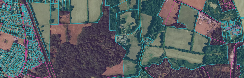
1. Core Products
We maintain two main tools: LandExplorer and MykoMaps. While they serve different communities and use cases, they share a common purpose - making complex systems visible and actionable.
LandExplorer helps people understand land ownership in England and Wales. MykoMaps helps networks and co-operatives visualise their ecosystems and connections.
These tools will continue to evolve independently, shaped by the distinct needs of the communities who use them. And they'll always be guided by our shared north star.
2. Product Delivery
Because we work as a small, part-time team, we are constantly challenging ourselves work more efficiently. For us, this means:
- Reusing design patterns, code, and frameworks across our tools wherever it makes sense
- Unifying our infrastructure - analytics, testing, deployment - so we're not reinventing the wheel
- Building systems that compound over time, where each improvement makes the next one easier
Think of it as creating a shared foundation that lets us move quickly and sustainably, even as our tools diverge in their specific features and directions.
3. Data in Service
We're also exploring how the data we steward can serve movements and communities in new ways. This becomes increasingly pressing as AI changes what is possible. More on this soon.
What We're Building Now
LandExplorer: Toward Sustainability
LandExplorer has been free since we launched it. That's enabled thousands of campaigners, journalists, and communities to access crucial information about land ownership. But it's also meant we've relied on short-term grants, which makes it hard to maintain data quality and build the features people need over the long term
Building on our conversations with the people using our tools, this year, we're experimenting with a community-supported model. We're introducing paid tiers in order to create a sustainable path forward.
The free tier will remain robust. We’ll continue to improve it with new layers and features, and the core of LandExplorer will remain free. We're improving it with better search functionality, so you can find land ownership by searching for proprietor names or addresses and the data that the tool depends on will be updated. These two things have been some of our most requested updates.
Paid tiers will fund ongoing improvements. By introducing paid tiers, we're giving better-resourced organisations and researchers a way to fund access for the grassroots groups who can't afford to pay. All current features, and almost all new features, will remain free to use. Some additional features will be only available to financial supporters.
This year our roadmap includes:
Our intention is to kick this off with a crowdfunder in mid-2026, giving our community a chance to shape what we build and help demonstrate that this model can work.
MykoMaps: Growing Networks
MykoMaps started as a tool for visualising data, such as large cooperative networks.
Our goal is to work with 7-8 new organisations to help them visualise their data and tell clearer stories to their audiences. We're starting with conversations with apex co-ops and food partnerships - organisations that already coordinate networks and could benefit from better visualisation tools.
Each map can be:
- Embedded directly in an organisation's website
- Shared with individual members to showcase their place in the network
- Updated and maintained through streamlined data workflows
We're still learning who needs this and what it's worth to them. That's the nature of experiment-driven development.
Why This Matters
In both cases, we're trying to solve the same fundamental problem: how do you build common infrastructure that serves movements and communities sustainably?
Our work so far has been funded by a mixture of grants and client work. We’re looking to change the proportion, from mostly grants to mostly clients and solidarity supporters. We believe that if we create tools that have real value, people will pay for them and this aligns our incentives more fully with the needs of our community of users. It lets us plan and fully own the roadmap together, with new feedback loops where the people using these tools have a direct say in how they evolve.
We don't know yet if it will work. We're treating 2026 as an experiment to test and learn from.
Building Together
One of our core beliefs is that the best tools are built with communities, not just for them. We're looking for partners in shaping these tools. Paid tier members will participate in roadmap planning. Crowdfunder supporters will help us prioritise which features to build first. And we'll continue listening to everyone using these tools, whether they're paying or not.
The systems we're mapping are complex, in part because powerful people benefit from that complexity. Our job is to cut through it. And we think the best way to do that is together.
Interested in supporting LandExplorer or bringing MykoMaps to your network? Get in touch!